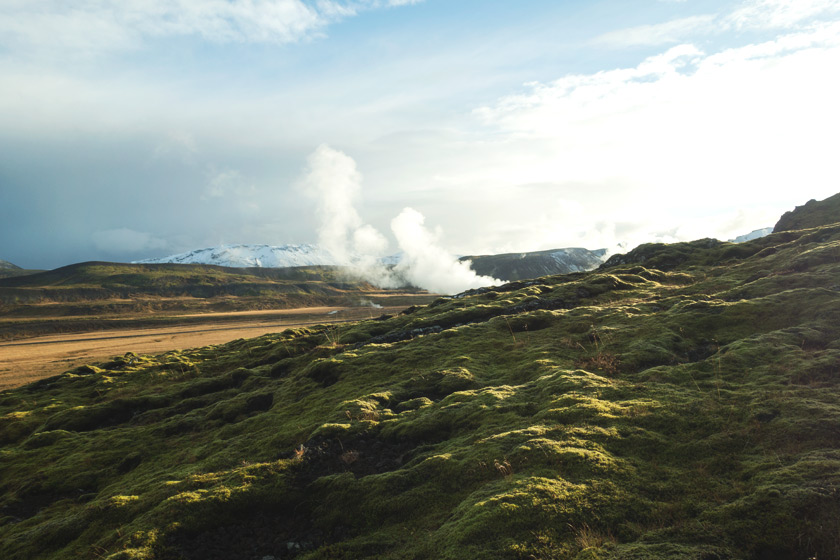
Nesjavellir is a geothermal area near the Hengill volcano (Southwest Iceland) and is home to Iceland’s second largest geothermal power station. The land is a mixture of mountain terrain, lava rocks, mud pots and boiling springs. Out of all our hikes, these trails were our favourite.
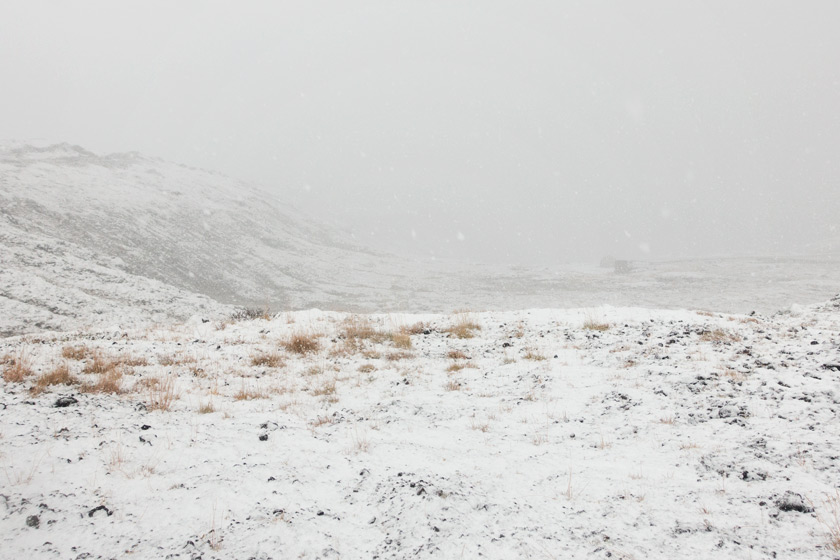
Our feet took us up high into the mountains and back down into the bottom of the valley. You’ll see from our photos that we experienced just about every type of weather in just three hours; snow fall, ice, wind, rain and sunshine!
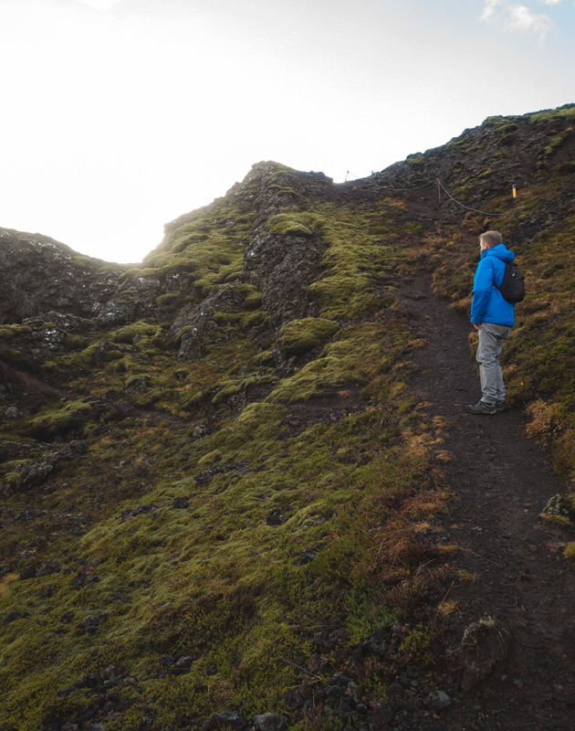
The paths were really steep in places but once our legs warmed up we were hiking like a pair of champs. If I’m honest, the chocolate chip cookies I was carrying in my bag might have helped too.
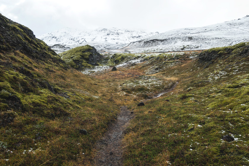
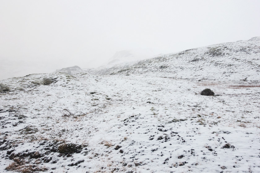
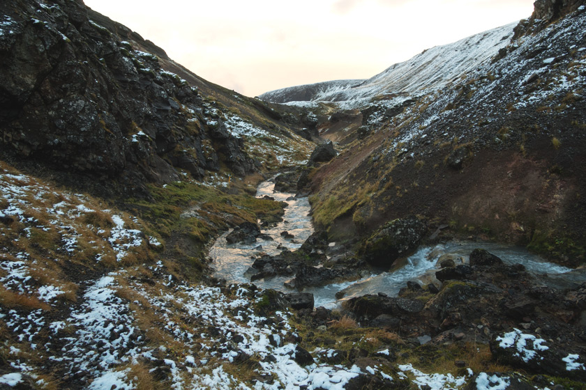
The higher we climbed, the more snow lay on the ground. Grey mist slowly crept over the top of the mountains, bringing snow and ice cold winds. I took a bazillion photos up here but limited it to two in this post because I want to show you what the whole walk was like.
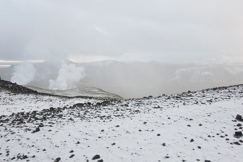
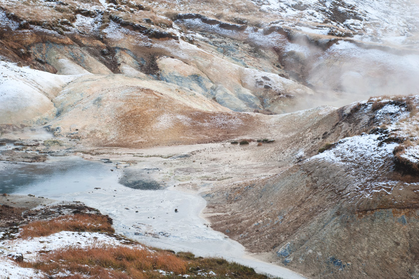
Dipping down into the valley we came across some hot springs; plumes of steam rising from water bubbling away between the rocks. Hot water too, 80°c – 100°c. Not the sort you want to take a dip in to warm up.
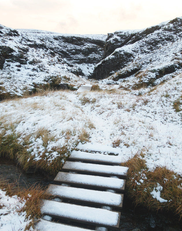
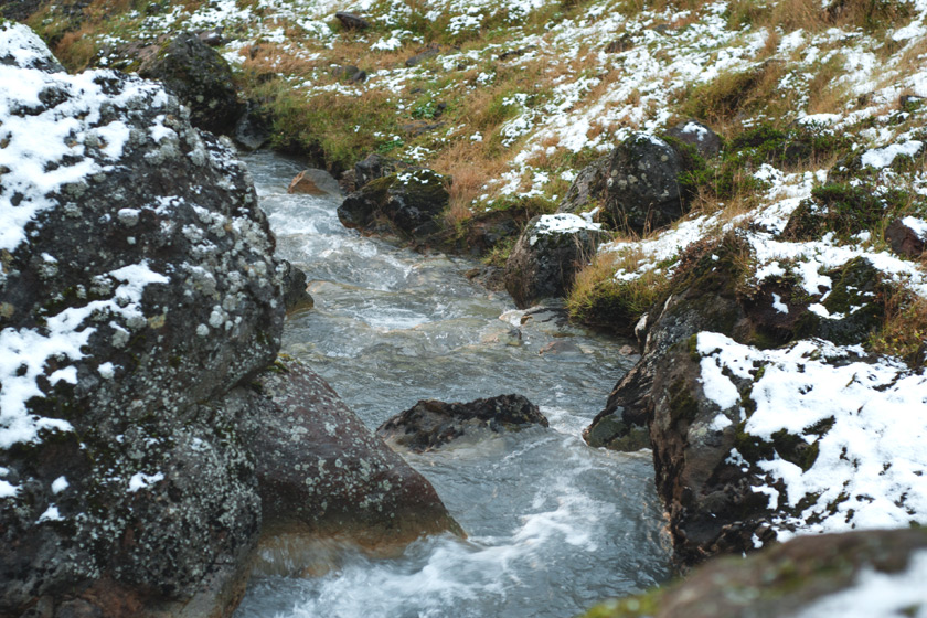
We clambered further into the valley, across little wooden bridges and down big rocks. I really enjoy this type of hiking. Looking ahead to plan out your route and where to put your feet. It’s good exercise for the brain as well as the body.
Scott had to help me across one of the hot streams on the map. It was quite high from all the rain and there was a single rock to use in the middle. My legs were only just long enough to reach it haha! And after seeing warnings for hot water I didn’t fancy falling in doing the splits. So he took his long legs over first and yanked me across once I’d made it to the rock. True gent.
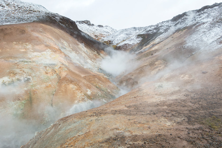
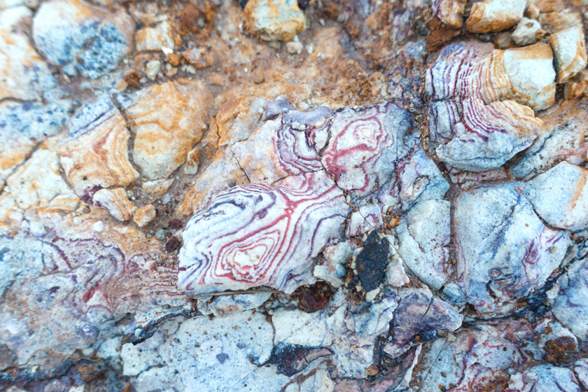
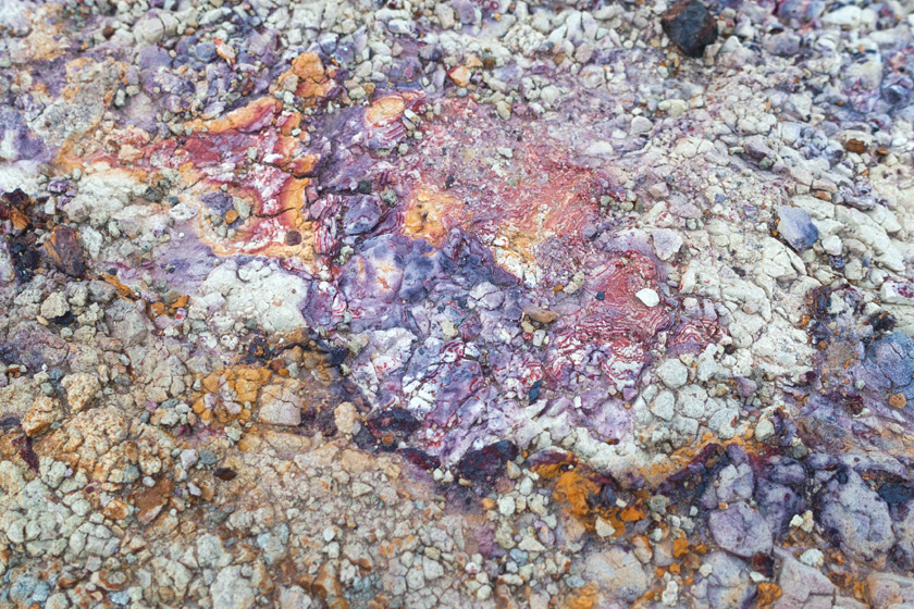
The second set of springs and mud pots we came across we even more beautiful than the first. Just look at the patterns and colours on these rocks!
We were now in the lowest point in the valley so the only way was back up. As we climbed higher the sky brightened but the sun was starting to set so we picked up the pace a little.
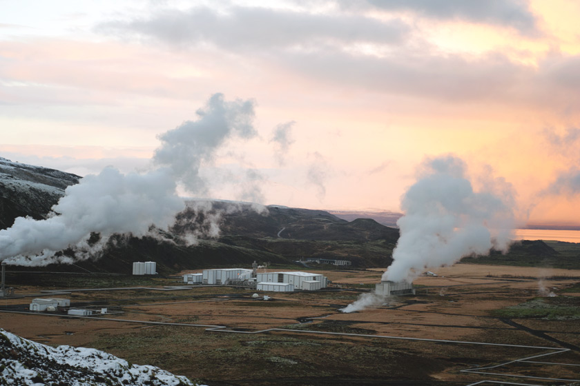
Below you can see the Nesjavellir geothermal plant. It may look like a monster on the landscape but it wasn’t at all because it was dwarfed by the scale of everything around it. Up close it was virtually silent, gently puffing water vapour into the sky. Who would have thought a power station could be peaceful!
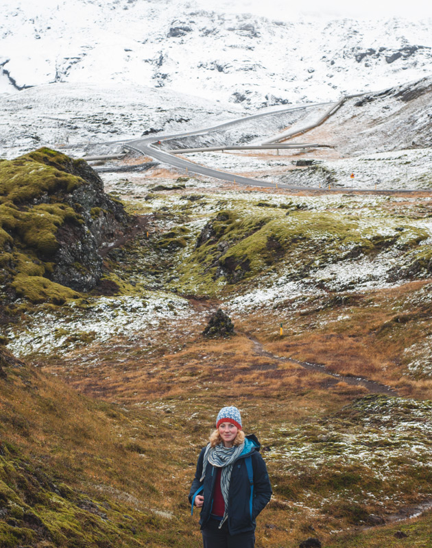
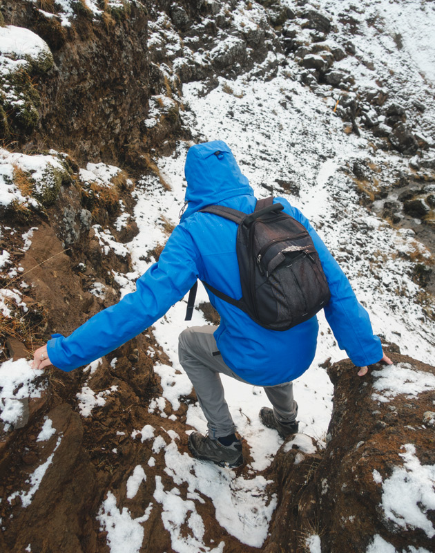
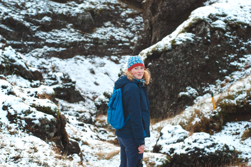
I look back at these photos now and I cannot believe we stood in such an amazing place. I’m a bit camera shy so don’t often post photos of myself but I wanted a record of me being here. And to show you the scale of everything. We didn’t see another soul on this hike so the only people who could add perspective were Scott and I 🙂
Oh, it is gorgeous! This makes me so excited that my husband & I have decided Iceland will be our next holiday (in May). Your hat is great, too. Is it a Kate Davies design? They’re always so cozy.
May sounds like a good time of year to visit, I hope you both have an amazing time! I’m planning on writing a few more posts about what we did in Iceland but if you want to pick my brains about anything on our trip feel free to send me a message from my Contact page. It is a Kate Davies design — Goats of Inversnaid 🙂 Such a warm hat.
Oh this makes me so happy!
Not only is it beautiful Iceland but I see you too enjoying it! It looks like a wonderful trip – what memories x
If you ever go back, I think you would really enjoy this hiking trail. Lots of moss too! It’s not often I make an appearance on my own blog 😉
How awesome?! It looks and sounds just wonderful, Gemma.
It was beautiful, I think you’d love it there. That big coat of yours will keep you warm enough!
What a nicely written account of your experience on this hiking trip in Iceland! I’m actually here now on vacation and, I must say, it is like no place I’ve ever been before. I would love to check out this hiking trail also. Do you know what it’s called or how I can get directions to it? I’m stauing at the ion adventure hotel right by the power station. Thanks!
Iceland is a truly amazing country! We found this trail through a map of the area from the front desk. The trail starts opposite the main entrance to the hotel and there are yellow markers and a few sign posts to guide you. We also used an app called Maps.me which is how we followed the trail down deeper into the valley. Hope you’ll love the trail as much as we did 😊
I’ve also found a photo of the trail in relation to the hotel so you can where we started from: https://photos.app.goo.gl/rOBBMFHPFh93HZrX2
Hi
loved the post… when did you go?
I wanted to go now at the end of march but road 435 is closed… is there any other way?
We visited in October. I’m not sure about alternative routes but if heavy snow falls, finding alternative routes could be tricky if the main ones are impassable. At one stage, it was looking like we might not get there if the snow continued. But luckily it eased off.